Locera Web App Integration
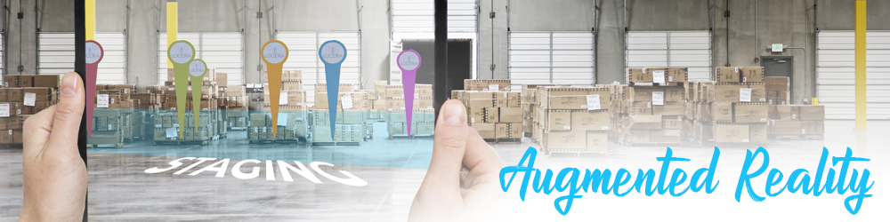
The Locera augmented reality companion app is a great way to see a live view of current transponders and geofenced areas. It’s also the go-to solution for setting up new geofenced areas while on the production floor. Whether it’s to find the live location of something, or to make sure a geofence is exactly where it needs to be, our AR companion app makes quick work of the task at hand.
How it Works
The AR companion app is always up to date with the latest information from your Real-Time Location System. As the RTLS updates it’s database, the Locera Application Programming Interface (API) filters out the data needed, and provides the AR companion app with the information. While using the app it checks for new data about transponders and geofences around once per second. Any new data will update the digital assets on your screen, ensuring the most recent data is displayed.
The Locera augmented reality companion app can be configured to work on a local network Locera API (On-Prem) or connected to the Locera Cloud API. Whichever way you roll, you’ll get the same real-time experience.
Easy Setup
You can be sure the AR information will match up to your real-world production environment with these 3 easy steps.
- Download the Locera AR companion app from the Locera Website on a mobile device.
- Point your mobile device toward an anchor point that was set up during your RTLS/Locera install.
- Walk around the facility and see everything on your 3D map from a first-person view.
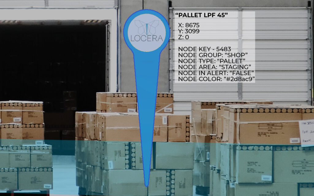
Real-Time Transponder Locations and Details
The AR app makes transponders easy to see at a distance. The digital marker’s name and associated information is visible in the user interface by walking to it or by tapping the on screen marker at a distance. Each transponder is visible in real-time while moving around the production floor, so you can always find and catch up to the item you’re looking for.
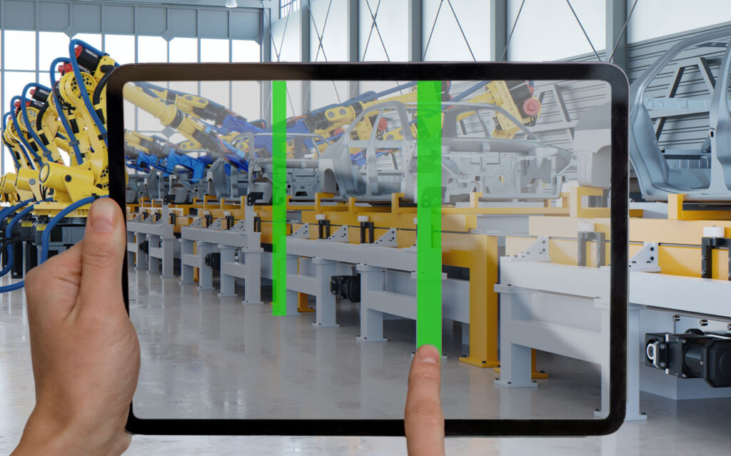
Geofence Creation From The Production Floor
The augmented reality companion app makes it easy to set geofenced areas in places that might be hard to locate on the Locera web app. When extreme accuracy is needed for an area not marked out on the floor plan, AR comes to the rescue. Creating and specifying everything about a geofence (name, type, color, height) that would normally be done in the web app, can now be done from the production floor at the exact spot needed. Simply tap the area on screen to place the markers.
How to Create Geofences
Setting up geofences in AR is just as easy as doing it on the 3D Map.
- Click on the menu button at the top right corner of the screen.
- Select the “Create Area” button.
- Enter a name, color, and select the area type from the drop-down list.
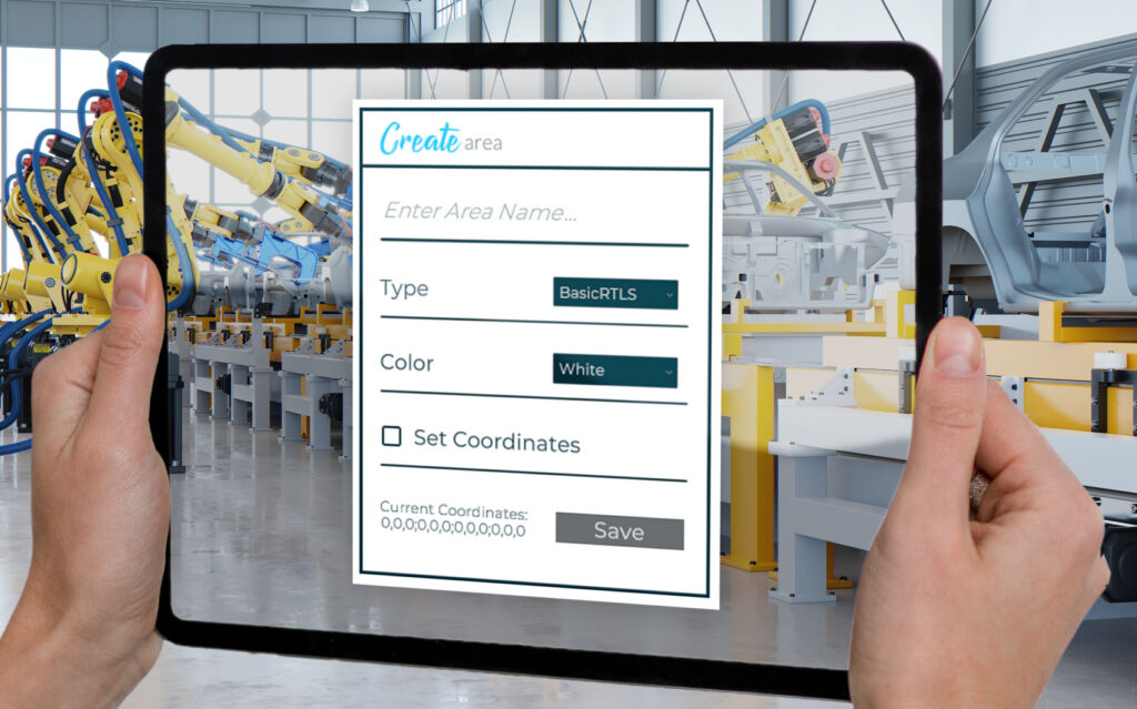
- Hit the “Set Coordinates” button.
- Tap on the screen of your mobile device to place the four corner markers of your geofence on the floor.
- Drag corner markers around with your finger to adjust.
- If type is “3D Area”, set a floor and ceiling height.
- Save and start using your new areas!
Get Started with the Augmented Reality Companion App!
By taking Locera to the shop floor with the AR companion app, you can easily visualize asset locations, areas, alerts and accurately setup geofenced areas while walking through your facility. The best part is it’s completely free and available as an RTLS user of Locera. So start making your life easier and download it today!
Demo, Questions, or Media Inquiries
To schedule a demo of Locera, please submit a request at:
https://locera.io/locera-demo/
For all media inquiries please send an email to:
media@kaasm.com
[DISPLAY_ULTIMATE_SOCIAL_ICONS]