The New Way To See RTLS
While Unity may have started out as a cross-platform game engine in 2005, during the last several years it’s become substantially more practical for business-oriented applications. Today’s industries increasingly rely on real-time data analysis, virtual training, virtual education, remote human-machine interfaces, and digital twins. Unity’s versatility and ease of use for prototyping and developing ideas meet these needs, and make it ideal to use in applications like Locera. Which is exactly what we did.
Locera 2.0 introduces a new 3D Map made with Unity that allows for rapid visualization of Real-Time Location Systems. This implementation makes it super easy to manage geofenced areas, upload a floor plan image, and see transponder details, locations, and history from a single webpage. And of course with Locera being cloud-native, you can monitor and manage from anywhere you have an internet connection. The addition of this mapping methodology adds to an already impressive feature set now included with the Locera suite of services. Click here to see the whole map in action!
Features
Locera 3D Maps made with Unity feature 6 areas of functionality to simplify the management of RTLS.
- Area Management
- Image Management
- Transponder Information at a Glance
- Active Boundary Polling
- Role-Based Access to Map Editing
- Camera and Label Settings
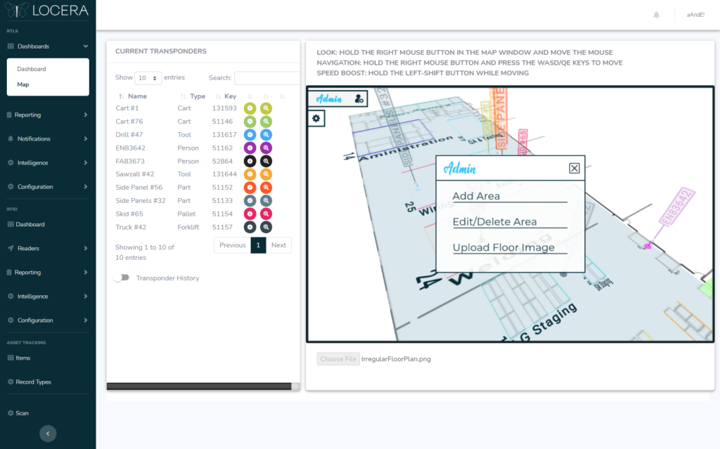
Area Management
One of the driving forces behind using 3D Maps for location-based intelligence is the ability to easily create and utilize stacked geofences. Track transponders vertically between shelves, racks, and lockers, as well as set customized alerts based on the shelf they are, or aren’t on. It’s super simple to edit all aspects of your geofences at any time from the map, or delete them entirely. Any changes made will be applied globally within seconds.
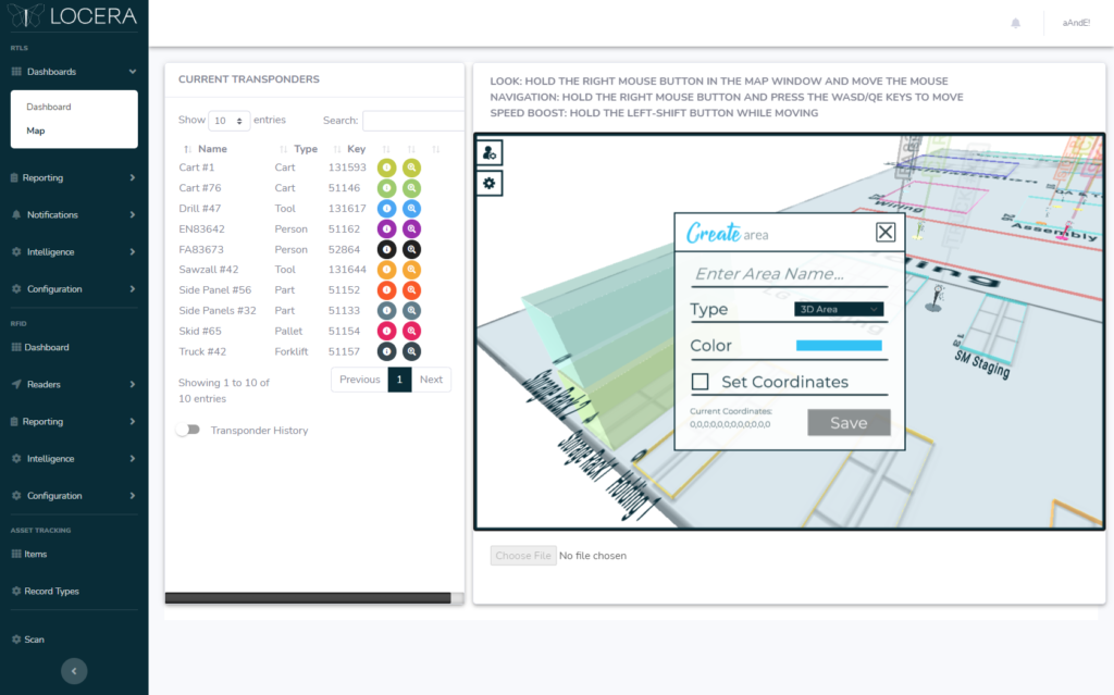
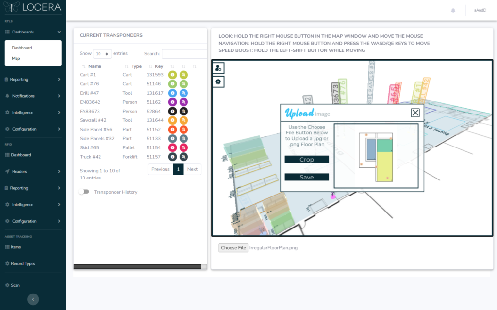
Image Management
The backbone of any good map is a floor plan. Really, none of this would make sense without it. Simply upload the .jpg or .png image of your floor plan at its native resolution. Use the built-in interface to crop the floor area where the RTLS system is located, and add the physical dimensions set by the RTLS installers. The image is then beamed to the cloud, or sent to the on-prem database if that’s how you want roll. Within seconds, all the functionality of the map is ready to rock!
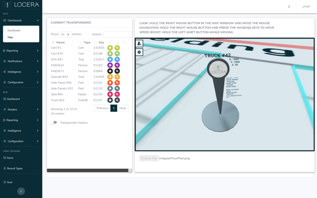
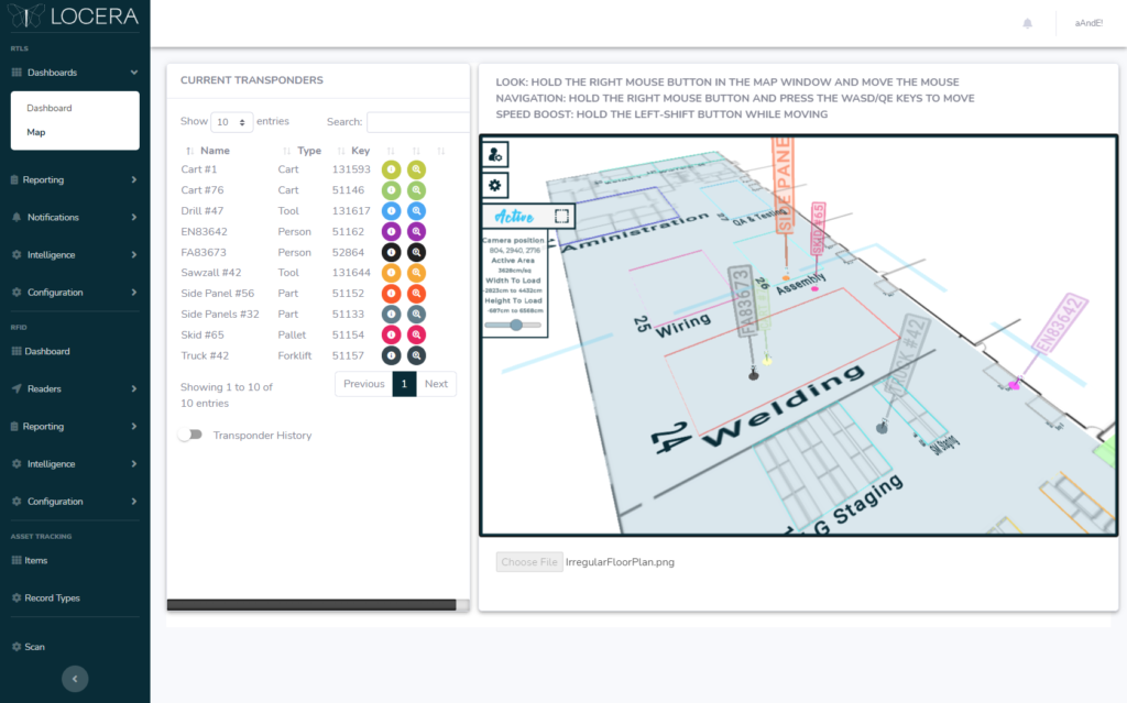
Transponder Information
Whether 10 or 10 hundred transponders, we’ve made it easy to locate, zoom-to, and see historical location data via breadcrumb trail for any date range needed. Clicking on a transponder in the left pane will highlight it on the map, while clicking the magnifying glass icon will zoom right to it as seen below.
Active Boundary
For large area, high transponder volume systems, we’ve included an “Active Boundary” feature to show only those transponders needed. By turning on Active Boundary in the Settings tab, you can set the size of the area you want to receive live transponder data from. The maximum boundary size is dynamically set based on the size of the facility, so you can cover as much or as little area as needed. The active boundary moves with your location, querying only the data closest to the camera.
Role-Based Editing
As with much of Locera, the 3D Map incorporates a “Role” check for permissions in order to add or edit geofences. For example, logging in with a “User” role will restrict access to the admin tab providing that functionality. Roles can be changed at any time from the main admin account.
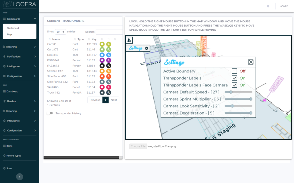
Camera & Label Settings
Don’t want to see all the transponder labels? Want to slow down or speed up faster while navigating the map? We’ve added a few settings that can be modified to make flying around the map easy and comfortable. Open the settings panel and adjust away!
Video Tour
Take a quick video tour of the 3D map made with Unity!
The Locera Connection
The 3D map made with Unity makes it super easy to view the real-time location of important assets and inventory in your facility, but Locera does so much more. Access to extensive location intelligence and history helps customers quickly achieve safety, efficiency, and regulatory results by automating the track and trace of assets, vehicle monitoring, and integration into existing systems. In the cloud or on-prem, Locera’s provides real-time data so you can know where everything is, from anywhere, at anytime. Click here to see how Locera can transform your operation!
Demo, Questions, or Media Inquiries
To schedule a demo of Locera, please submit a request at:
https://locera.io/locera-demo/
For all media inquiries please send an email to:
media@kaasm.com
[DISPLAY_ULTIMATE_SOCIAL_ICONS]